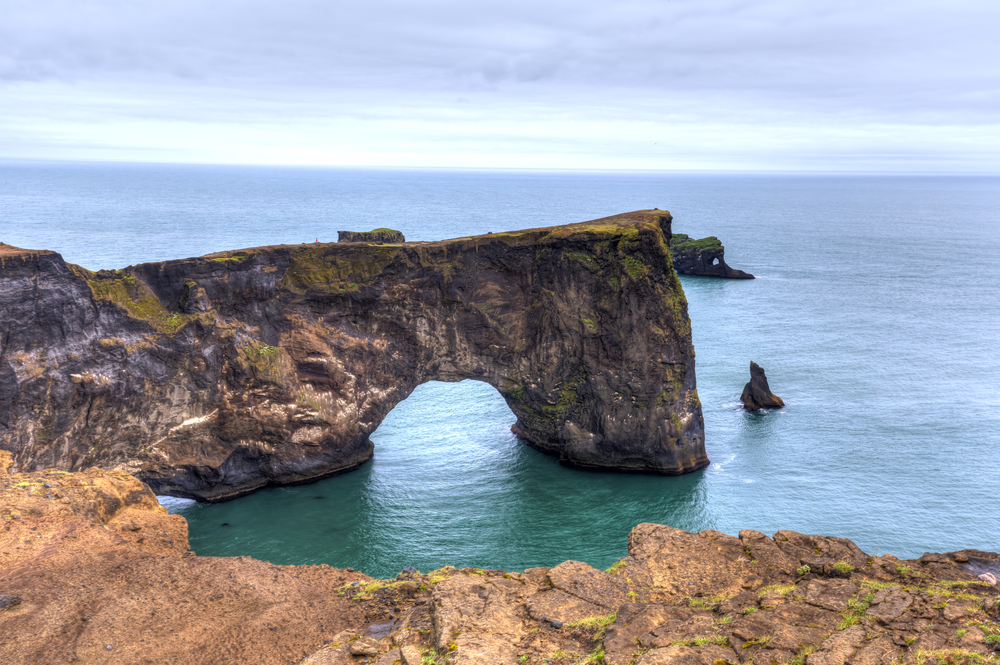

Dyrhólaey Peninsula sits on Iceland's south coast, about three kilometres west of Vík, and is one of the most rewarding stops on any Ring Road or south-coast itinerary. The headland is known for its sea arch, a lighthouse at one of Iceland's southernmost points, a large puffin colony in summer, and broad views across black-sand beaches toward Reynisdrangar. Because public transport does not reach the peninsula and guided tours rarely allow more than a quick stop, driving yourself is the most practical way to see Dyrhólaey properly.
Before hitting the road, skim our guide on how to prepare for an Iceland driving trip and brush up on Icelandic road-sign basics so nothing catches you off-guard.
Why visit Dyrhólaey by rental car?
A rental car is the practical choice for Dyrhólaey because the peninsula is only reachable via Route 218, a short spur off the Ring Road with no scheduled bus service. Having your own vehicle means you can:
- Time your visit around weather and light. If fog sits over the headland, drive into Vík or down to Reynisfjara and return when visibility lifts.
- Reach both car parks (lower beach and upper lighthouse) without relying on anyone else's schedule.
- Combine multiple stops in a single day, such as Seljalandsfoss, Skógafoss, Sólheimajökull, and the Sólheimasandur plane wreck, without backtracking or waiting for connections.

Getting there: driving directions and parking
From Reykjavík, follow Route 1 east for roughly 178 km (about 2 hours 25 minutes in normal conditions). Pass Seljalandsfoss and Skógafoss, then turn right onto Route 218 (Dyrhólavegur) approximately 10 km before Vík.
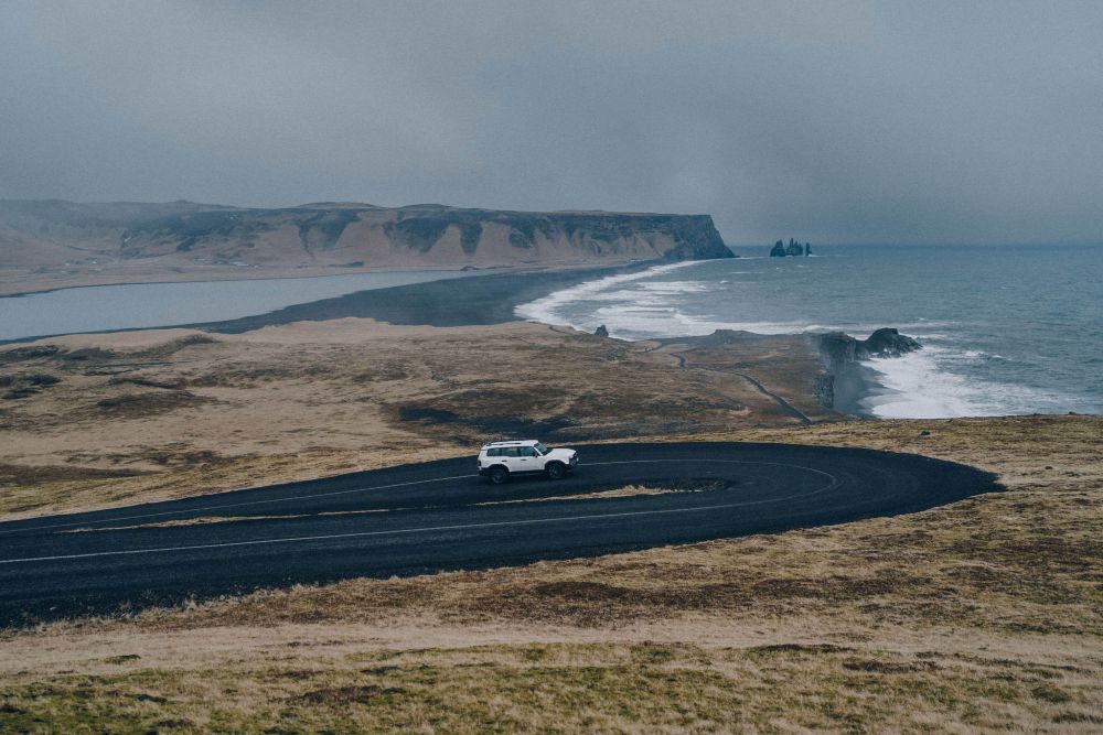
The road is paved until the final stretch. The lower car park at Kirkjufjara Beach is reached first; continue up the gravel switchback to the upper car park beside the lighthouse. That upper climb is steep and narrow, and a 4x4 handles it more comfortably than a small 2WD, particularly on wet or icy gravel.
New to Icelandic rules of the road? Review which side we drive on and keep speeds low on gravel.
| Detail | Information |
|---|---|
| Distance from Reykjavík | 178 km |
| Approximate drive time | 2 hr 25 min (normal conditions) |
| Turn-off from Ring Road | Route 218 (Dyrhólavegur), ~10 km west of Vík |
| Road surface | Paved to lower car park; steep gravel to upper |
| Parking | Two car parks: lower (Kirkjufjara) and upper (lighthouse) |
| Vehicle recommendation | 4x4 recommended for upper road; 2WD manageable in dry summer conditions |
| Nearest fuel | Vík, approximately 10 km east |
Top sights on Dyrhólaey Peninsula
The sea arch
The natural rock arch that gives Dyrhólaey ("door-hill-island") its name is visible from several vantage points on the upper promontory. On calm days, seabirds glide through the opening or rest on the basalt ledges below.
Dyrhólaey lighthouse
The lighthouse crowns the headland and offers one of the widest panoramas on the south coast, with Mýrdalsjökull glacier to the north and Reynisdrangar sea stacks to the east. The lighthouse headland sits at approximately 63°24′N, making it one of Iceland's southernmost accessible viewpoints. Walk the short loop around the cliff edge for the full view.
Puffin viewing (May to August)
Each summer the grassy headland becomes one of Iceland's most accessible puffin colonies. Keep a respectful distance from the cliff edges, move slowly, and use a zoom lens or binoculars rather than approaching the birds directly.
Kirkjufjara and Reynisfjara beaches
From the lower car park, a path leads to Kirkjufjara's windswept shore. Drive or walk east to reach world-famous Reynisfjara. Obey all safety signs and stay well clear of sneaker waves at both beaches. Conditions can shift quickly, and the surf here has a serious pull.
A suggested half-day itinerary from Reykjavík
The stops below work in this order for most travellers, but you can reverse the sequence if you are staying in Vík and heading west.
- Morning departure from Reykjavík. Stop at Seljalandsfoss for a walk behind the cascade (allow 30 to 45 minutes).
- Mid-morning at Skógafoss. Climb the viewing staircase alongside the falls for a top-down perspective. The staircase has over 300 steps, so allow extra time if you plan to go all the way up.
- Early afternoon at Dyrhólaey. Explore the lower beach first, then drive to the upper car park for the lighthouse trail and puffin cliff.
- Late afternoon at Reynisfjara for basalt-column photos and a stop at the beach café.
- Evening in Vík. Fill the tank, check into your accommodation, and watch the light fade over the sea stacks.
With a rental car you can reorder or slow down wherever the conditions are best.
Photography tips
- Golden hour (the hour after sunrise and the hour before sunset) casts warm, raking light on the arch and lighthouse. In summer, sunset can come very late, so check the time before heading back to your accommodation.
- For puffins, a 200 mm focal length is a practical minimum. Stay still and let the birds approach rather than moving toward them.
- A wide-angle lens in the 14 to 24 mm range captures the full sweep of the Atlantic and the black-sand beaches below the headland.
Practical driving tips for this stretch of the south coast
The south coast between Reykjavík and Vík is one of Iceland's better-maintained driving corridors, but a few things are worth keeping in mind.
Check conditions before you leave. Weather on the south coast changes quickly. Check road.is and SafeTravel.is for road status and any closures on Route 218 before departure.
Fuel up before turning off the Ring Road. The nearest station is in Vík, about 10 km east of the Dyrhólaey turn-off. If you are coming from Reykjavík, top up at Hvolsvöllur or Selfoss to give yourself a comfortable buffer.
Choose your vehicle for the upper road. The gravel switchback to the lighthouse car park is manageable in a 2WD on a dry summer day but becomes noticeably trickier after rain or in shoulder-season conditions. A 4x4 removes the uncertainty. Iceland's south coast roads are discussed in more detail in our guide to Iceland's must-see waterfalls accessible by rental car, which covers many of the same stops.
Plan for limited or variable mobile coverage. Download offline maps before you leave Reykjavík. Coverage is generally reasonable along Route 1 but can be patchy on the peninsula itself.
Renting a car for your south-coast trip
Blue Car Rental is an Icelandic company with a fleet maintained for local road conditions, ranging from small 2WD cars suited to summer paved routes to larger 4x4 SUVs for gravel access roads and unpredictable coastal weather. Online check-in and key-box pickup at Keflavik Airport means you can skip the counter and be on Route 1 without delay.
Our premium insurance option reduces your excess to zero and includes roadside assistance, which is worth considering on any itinerary that takes you off the main highway. Transparent pricing is backed by our Zero Worries policy, so there are no surprises at drop-off.
Final thoughts
Dyrhólaey packs staggering views, accessible wildlife, and dramatic coastal geology into a compact headland that most tour groups pass through in under an hour. With your own vehicle, you can take the upper lighthouse loop at your own pace, wait out the fog, and time the puffin cliff for the best light. It fits naturally into a south-coast day trip from Reykjavík or as a stop on a longer Ring Road circuit.
 CAN YOU DRINK TAP WATER IN ICELAND?