
Iceland exists because of two geological forces working together: it sits directly on top of the Mid-Atlantic Ridge, where two tectonic plates are pulling apart, and it also sits above a mantle plume, a column of unusually hot rock rising from deep inside the Earth. Together, these forces have built the island out of the ocean floor over millions of years, and they're still building it today. This matters for travellers because the geology isn't just background trivia, it's the reason the Ring Road passes through lava fields, rift valleys, and steaming volcanic regions instead of the greener, quieter countryside you'd find in most of Europe.
Short answer: Iceland formed because the Mid-Atlantic Ridge, the boundary between the North American and Eurasian tectonic plates, happens to pass through a mantle plume, or hotspot, in the North Atlantic. The extra heat from the plume caused so much extra volcanic material to pile up along the ridge that it broke the surface of the ocean, roughly 16–18 million years ago, and kept growing from there. It's one of the very few places on Earth where a mid-ocean ridge rises above sea level, and by far the easiest to visit.
Where does Iceland sit on the Mid-Atlantic Ridge?
Iceland sits directly on top of the Mid-Atlantic Ridge, the underwater mountain chain that runs the length of the Atlantic Ocean and marks the boundary between the North American plate and the Eurasian plate. For most of its length, this ridge lies thousands of metres below the ocean surface. In Iceland, it rises above sea level, which is why the country is one of the very few places where you can walk across an active plate boundary rather than just read about one.
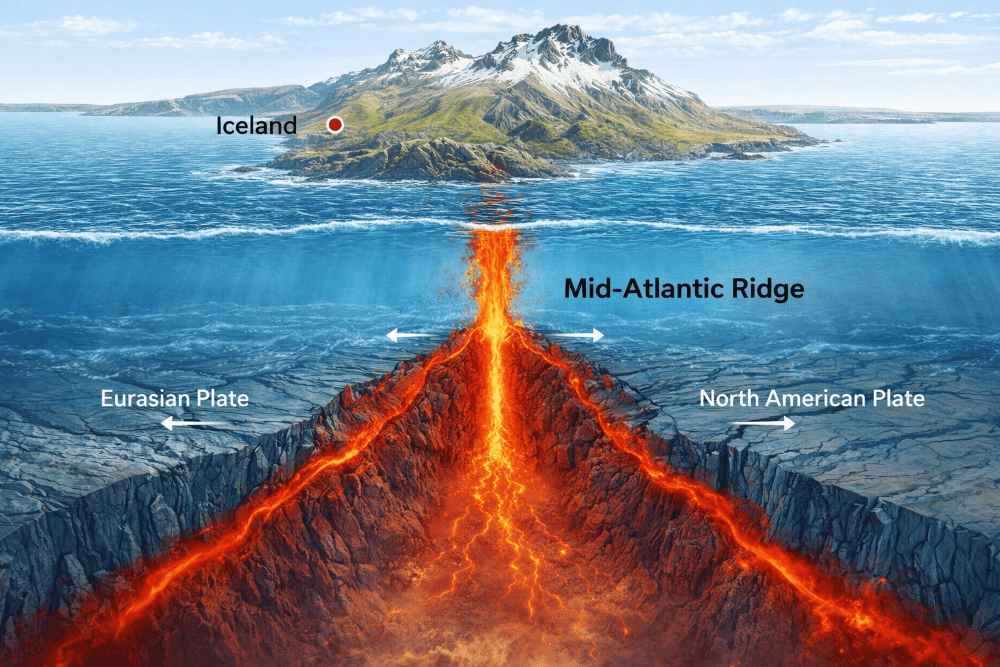
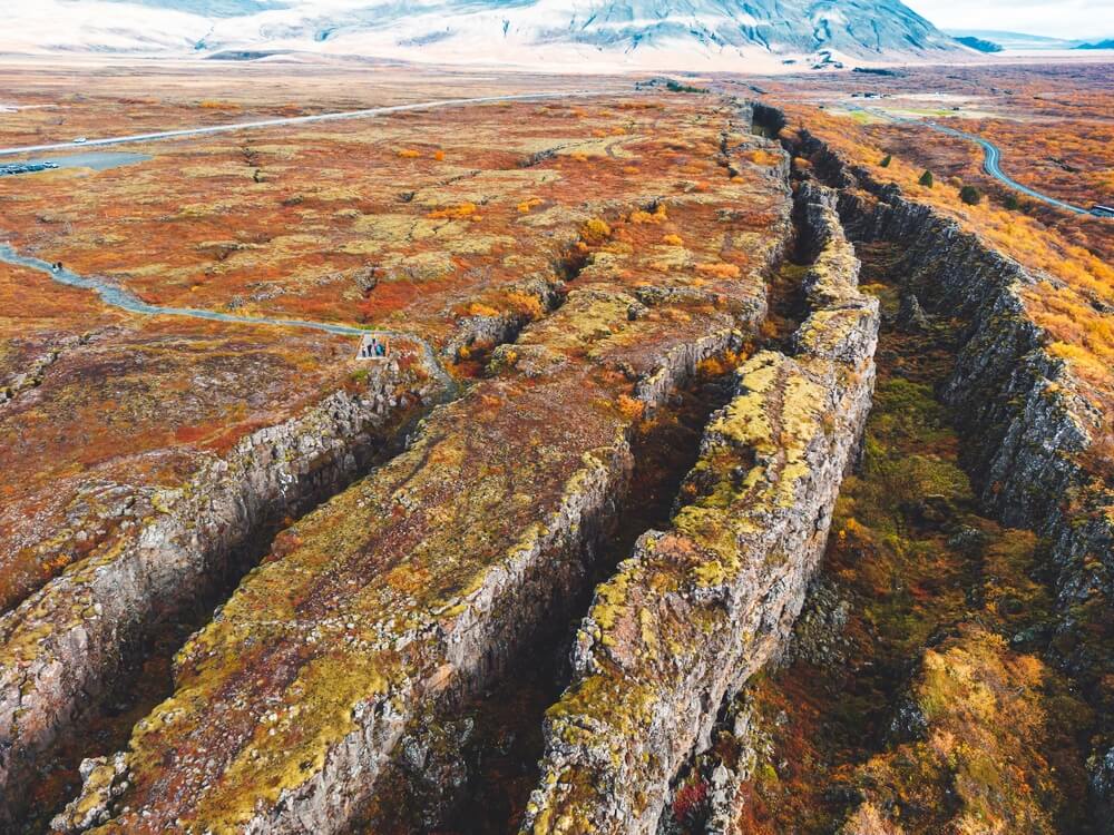
The two plates here are diverging, moving apart from each other, at a rate of roughly 2 cm per year. That sounds small, but over geological time it's enough to have shaped an entire landscape. As the plates separate, magma rises to fill the gap, cools, and becomes new crust. This process is visible in several places around the country, most famously at Þingvellir National Park, where you can stand in the rift valley between the two plates.
How was Iceland formed geologically?
Iceland was built by repeated volcanic eruptions along the Mid-Atlantic Ridge, intensified by a mantle plume sitting underneath the region. Volcanic activity in the North Atlantic long predates the island, but Iceland itself, the land above sea level, only began forming about 16–18 million years ago, once tens of millions of years of accumulated lava had finally built up enough to break the ocean's surface.
The oldest exposed rocks in the country, found in the Westfjords and the Eastfjords, are about 16 million years old, these are the earliest parts of Iceland that rose above the waterline as volcanic material built up layer by layer. Everything since has grown from there. Because the plates keep separating along the ridge, new land is constantly created near the centre of the island, which means the middle of Iceland is geologically the youngest ground, while the outer coastal regions are the oldest.
Without the mantle plume, most geologists agree Iceland likely wouldn't exist as dry land at all, the ridge would simply be another submerged mountain chain like the rest of the Mid-Atlantic Ridge. It's the combination of ridge plus plume that makes Iceland unusual.
Why is Iceland the only part of the Mid-Atlantic Ridge above sea level?
Iceland rises above sea level because it sits at the intersection of the Mid-Atlantic Ridge and a mantle plume, a localized source of extra heat and magma supply that doesn't exist along most of the ridge's length. Everywhere else, the ridge produces enough new crust to stay submerged under the ocean. In Iceland, the additional magma from the plume built up volcanic material faster than the ocean could keep it submerged, eventually pushing land above the surface.
This is also why Iceland has such intense geothermal activity compared to other volcanic regions, the mantle plume sits close enough to the surface here to heat groundwater across much of the country, feeding the geysers, hot springs, and geothermal valleys travellers associate with the island.
How old is Iceland, and where can you see its geological history?
Geologically speaking, Iceland is young, around 16 to 18 million years old, depending on which exposed rock formations are used to date it. That makes it one of the youngest landmasses on Earth, especially compared to the surrounding continents, which are hundreds of millions to billions of years old. This youth is part of why the landscape looks the way it does: raw lava fields, sparse vegetation, and terrain still being reshaped by glaciers, wind, and water.
Different regions of the country show different stages of that history, and several are accessible on a self-drive route:
| Location | What it shows | Typical accessibility |
|---|---|---|
| Þingvellir National Park | Rift valley between the North American and Eurasian plates, visible cliffs and fissures | Paved roads, open year-round, easy from Reykjavík |
| Reykjanes Peninsula (Bridge Between Continents) | A symbolic crossing point over the plate boundary, plus recent lava fields from 2021–2024 eruptions | Mostly paved, close to Keflavík Airport |
| Westfjords / Eastfjords | Oldest exposed rock in Iceland, around 16 million years old | Paved and gravel roads, best in summer; some routes limited in winter |
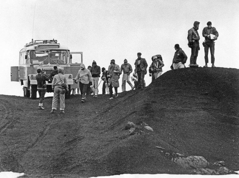
| Askja Caldera (Highlands) | Volcanic terrain used by NASA to train astronauts in the 1960s | F-road access only, seasonal, typically open mid-June to September, weather dependent |
Road access and opening dates for highland routes change from year to year, so always check current conditions on road.is or safetravel.is before planning a highland detour, and confirm with the F-roads guide to the highlands whether your vehicle is suited to the route.
Is Iceland still growing today?
Yes. As the North American and Eurasian plates continue to separate along the Mid-Atlantic Ridge, magma keeps rising and forming new land, particularly along the central rift zone that runs through the country. Iceland is one of the few places on Earth where this land-building process is fast enough, and visible enough, to observe within a human lifetime, recent eruptions on the Reykjanes Peninsula are a direct, current example of the same process that built the whole island.
Earthquakes and volcanic eruptions are simply part of this ongoing activity rather than isolated events. It's also why Iceland has an unusually high concentration of geothermal areas, hot springs, and active volcanic zones for its size.
Why Iceland's landscape looks the way it does
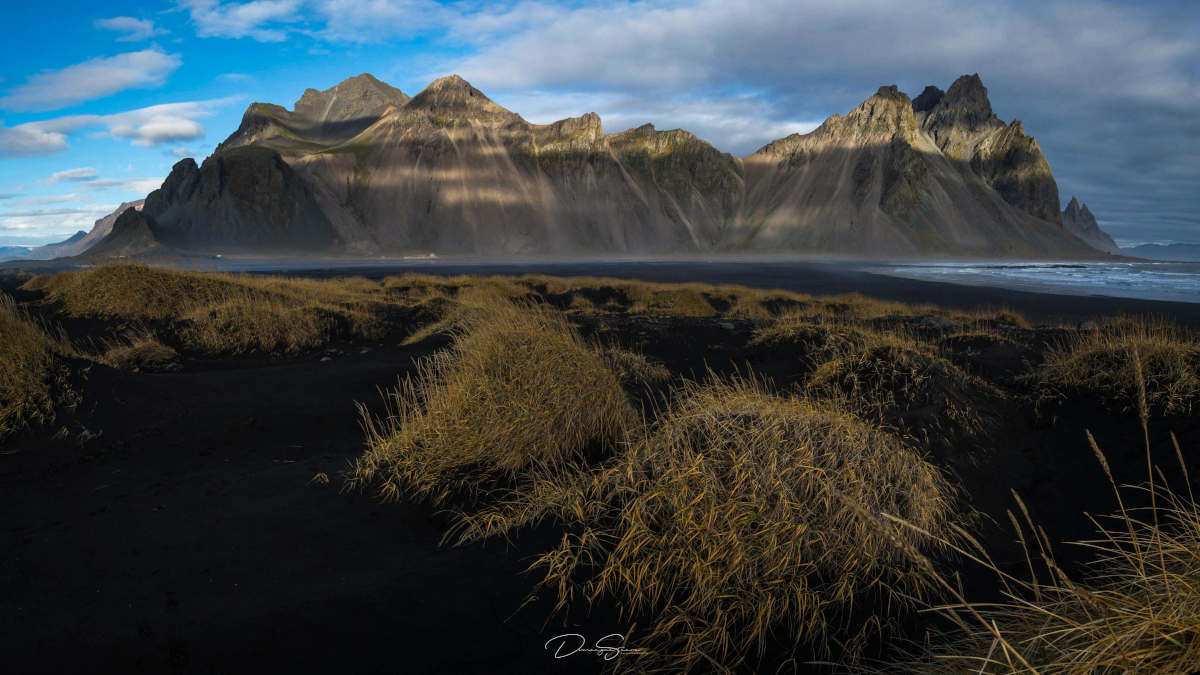
The combination of active volcanism, glacial erosion, and thin vegetation gives Iceland a landscape often described as otherworldly. In the 1960s, NASA used the Askja Caldera in North Iceland to help prepare astronauts for lunar missions, because the terrain there resembles the moon's surface closely enough to be useful training ground. Black sand beaches, lava deserts, and steaming valleys around the country all trace back to the same origin: a young island still forming at the meeting point of two tectonic plates.
Seeing the Mid-Atlantic Ridge on a self-drive trip
Most of the classic geological sites, Þingvellir, the Reykjanes Peninsula, and the Golden Circle route generally, are reachable on paved roads with a standard 2WD car, especially outside winter. Sites further into the interior, like Askja, require an F-road-rated 4x4 and are only open for a limited season, so they need more planning around vehicle choice and timing. If you're deciding between a 2WD and 4x4 for your route, the 4x4 vs 2WD comparison is a useful starting point.
Winter changes the picture: daylight is shorter, some roads close seasonally, and conditions on exposed routes like parts of the Westfjords can shift quickly. If you're travelling between November and March, it's worth reading through driving in Iceland in winter before finalising your itinerary. For a broader look at other natural sights tied to the same volcanic and glacial forces, the natural wonders guide is a good next stop, and if you're planning around the quieter shoulder season, the summer road trip guide covers timing for the warmer months.
Whichever route you take, picking a vehicle that matches your planned roads and season makes the geology-focused stops far less stressful to reach.
 CAN YOU DRINK TAP WATER IN ICELAND?