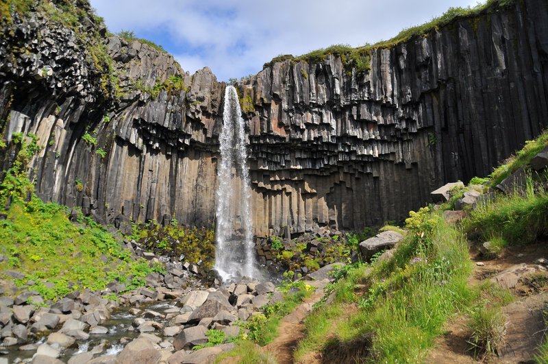

Svartifoss is a waterfall in Skaftafell, inside Vatnajökull National Park in southeast Iceland, best known for the dark hexagonal basalt columns that frame the falling water. It's one of the more distinctive short hikes along the Ring Road, and it's a common stop for self-drive travellers working their way between the South Coast and the glacier lagoons further east. This guide covers what the waterfall actually looks like, how to reach it on foot, when to go, and how it fits into a wider road trip.
Quick answer: Svartifoss ("black waterfall" in Icelandic) drops around 20 metres over a cliff lined with black basalt columns, formed by slowly cooling lava. It sits inside Skaftafell, a section of Vatnajökull National Park just off the Ring Road (Route 1) in southeast Iceland. The standard trail from the Skaftafell visitor centre is about 1.5 km one way and takes roughly 40–45 minutes to walk, with a steeper final stretch. It's open and hikeable year-round, though winter conditions can make the path icy and slower going.
Why Svartifoss stands out among Iceland's waterfalls
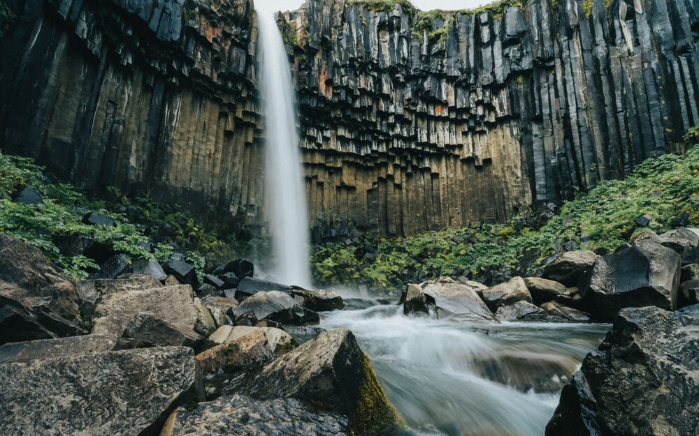
Svartifoss isn't Iceland's tallest or highest-volume waterfall, but the basalt columns around it make it one of the most photographed. The dark, hexagonal rock formed as thick lava cooled slowly and cracked into regular columns, a process geologists call columnar jointing. Cold glacial meltwater running down through Vatnajökull National Park then carved the black waterfall shape you see today.
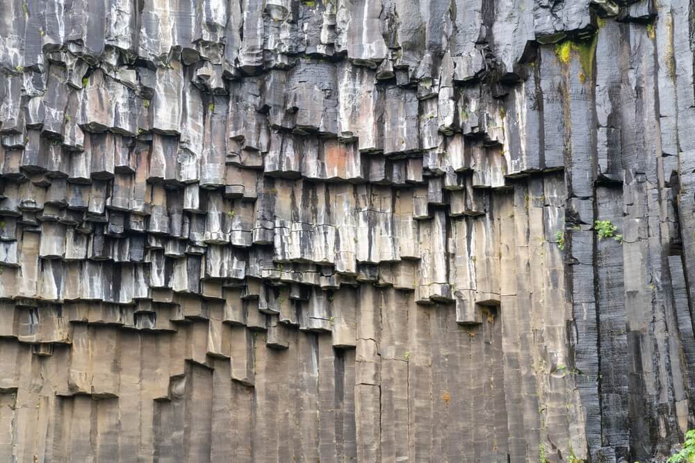
The visual pairing of white water against near-black rock is the reason Svartifoss shows up in so many "Iceland basalt waterfall" searches and photo feeds. It's also said to have influenced the design of Hallgrímskirkja church in Reykjavík, whose front facade echoes the same columnar pattern. Compared with more common single-drop waterfalls elsewhere on the South Coast road trip, Svartifoss offers a genuinely different shape and texture.
Key reasons travellers add it to their route:
- Distinctive basalt column setting, unlike most other Iceland waterfalls
- A short, manageable hike rather than a roadside stop
- Located inside Vatnajökull National Park, with other trails nearby
- A reliable stop between the South Coast and the glacier lagoon region further east
Getting to Skaftafell and the Svartifoss trailhead
Skaftafell sits just off the Ring Road (Route 1) in southeast Iceland, reached by a short signposted turn from the main highway. The Skaftafell visitor centre, run in connection with Vatnajökull National Park, is the starting point for every route to Svartifoss and has parking, restrooms, maps, and staff who can advise on current trail conditions.
After crossing the black volcanic sands further west along the Ring Road, the green, sheltered landscape around Skaftafell feels like a distinct change of scenery. It's a natural place to stop and stretch before continuing east toward Jökulsárlón or west back toward Vík.
At the visitor centre you can typically:
- Pick up a trail map before setting out
- Ask about current trail and weather conditions
- Use restrooms and facilities before the hike
- Book glacier walks or other guided tours in the area
How to hike to Svartifoss
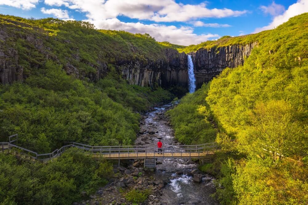
There are two main ways to reach the waterfall from the visitor centre, and which one suits you depends on time and fitness rather than any technical difficulty, no special gear or 4x4 access is needed for the hike itself, since this is entirely a walking trail.
| Route | Distance (one way) | Time (one way) | Difficulty | Best for |
|---|---|---|---|---|
| Direct trail | ~1.5 km | 40–45 minutes | Moderate, steeper near the top | Most visitors, tighter Ring Road schedules |
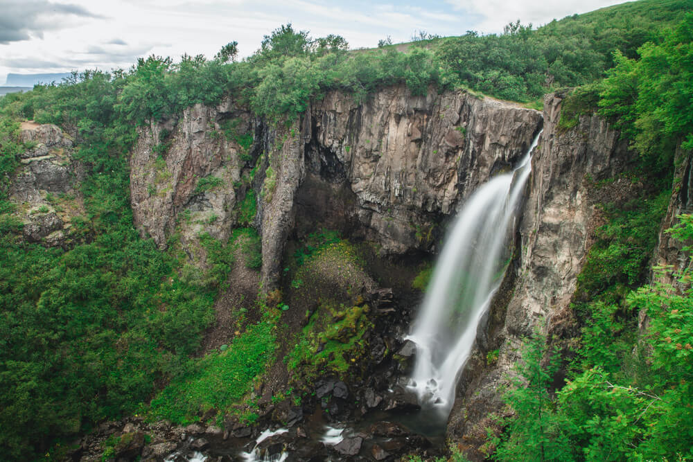
| Longer loop via Hundafoss | ~3.4 km (approx., route-dependent) | Longer, varies by pace | Moderate, more elevation change | Travellers with extra time who want more viewpoints and fewer crowds |
Most people budget around 1.5–2 hours total for the direct route, including photo time at the falls. If Skaftafell is one stop among several on a South Coast day, the shorter trail keeps your schedule realistic; if you're staying in the area longer, the Hundafoss route adds a couple of smaller waterfalls along the way.
Best time of year to visit Svartifoss
Svartifoss is accessible for most of the year, but conditions on the trail change noticeably with the seasons, and this affects both difficulty and how long the walk takes.
| Season | Trail conditions | Crowds | Notes |
|---|---|---|---|
| Summer (Jun–Aug) | Dry, firm path, easiest walking | Busiest | Long daylight hours give flexibility on timing |
| Autumn / Spring | Generally manageable, can be wet | Moderate | Good balance of conditions and fewer people |
| Winter (Nov–Mar) | Can be icy or snow-covered, steeper section harder | Quietest | Trail can take longer; check conditions before setting out |
Whatever the season, it's worth checking current road and trail information before you go, conditions can change quickly in this part of Iceland. The Icelandic Road Administration (road.is / umferdin.is) covers the Ring Road itself, and Safetravel.is is useful for general trip conditions. If you're visiting outside summer, it's worth reading through a winter driving guide before continuing east or west from Skaftafell, since road conditions on this stretch can differ from what you find closer to Reykjavík.
Photographing the basalt columns
Svartifoss rewards a bit of patience more than expensive gear. The columns give you a natural geometric frame, so composition matters more than equipment.
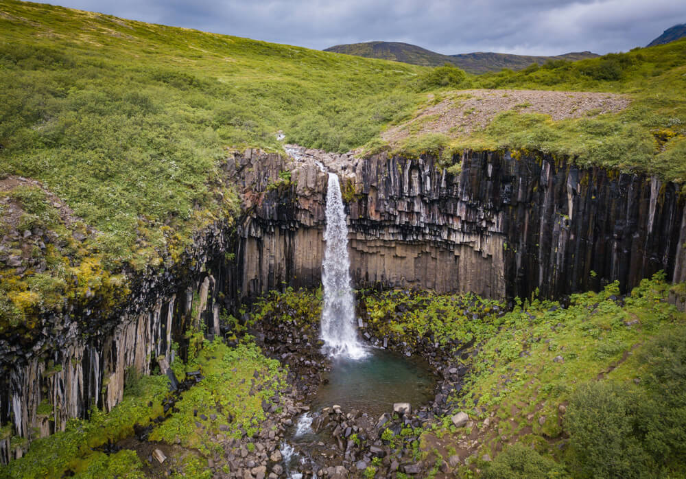
- A tripod helps for longer exposures if you want the classic silky-water look
- Early morning or late afternoon light is softer and reduces harsh shadows on the black rock
- Try shooting from slightly off-centre to let the columns lead the eye toward the falls
- Including a person in the frame gives a useful sense of scale, since photos alone can make the drop look smaller than it is
Mistakes to avoid at Svartifoss
A few small planning missteps account for most of the frustration travellers report after visiting:
- Underestimating the return climb. The final stretch up to the falls is steeper than the first part of the trail, and it's easy to forget you have to walk back down the same way.
- Skipping proper footwear. The path is uneven in places and can be muddy or icy depending on season; regular sneakers are workable in dry summer conditions but not ideal otherwise.
- Rushing it as a five-minute stop. Because it's a hike rather than a roadside waterfall, trying to fit it into too tight a Ring Road schedule often means turning back before reaching the falls.
- Not checking conditions in shoulder season or winter. Trail closures or icy sections aren't always obvious from the visitor centre car park.
Fitting Svartifoss into a self-drive route
Skaftafell works well as a stop on a longer South Coast or full Ring Road itinerary, sitting between the glacier lagoons to the east and Vík or the Golden Circle region to the west. Because it's a signposted detour rather than a remote F-road destination, a standard rental car is enough to reach the visitor centre in normal summer conditions, this isn't a location that requires a 4x4 on its own. If your route also includes highland detours or gravel side roads elsewhere, it's worth working through whether a 4x4 makes sense for the rest of your trip before you book.
Having your own car makes stops like this straightforward: you can arrive early to avoid the busiest hours, adjust your pace based on trail conditions, and continue on to nearby attractions in Vatnajökull National Park without waiting on a tour schedule. If you're picking up a car at Keflavík, Blue Car Rental's online check-in and key-box pickup can help you get on the road with less time spent at the airport counter. Travellers combining Svartifoss with other short hikes along the way might also find the canyon hiking guide useful for planning additional stops, or the summer road trip guide if you're building out a longer warm-season itinerary.
 CAN YOU DRINK TAP WATER IN ICELAND?