
Iceland has more striking landscapes than any single trip can cover, so the real question isn't "what are the top attractions" but "which ones fit the route and season you're driving in." This guide names the sights that consistently draw the most visitors, groups them by region, and explains how to string them together on a self-drive itinerary without overloading your days behind the wheel.
Short answer
Iceland's most visited natural attractions are Jökulsárlón glacier lagoon and Diamond Beach, Reynisfjara black sand beach and Dyrhólaey in the south, Dettifoss waterfall and Mývatn in the north, Stuðlagil canyon in the east, Deildartunguhver hot spring in the west, and Látrabjarg bird cliff in the Westfjords. Most sit along or just off Route 1 (the Ring Road), so a full loop of the island gives you access to nearly all of them, provided you allow enough days and check road conditions for the season you're travelling in.
Which attractions make the list, and why
Icelanders and repeat visitors tend to agree on a shortlist of sights that combine easy access from the Ring Road with genuinely distinct scenery, glacier lagoons, waterfalls, sea cliffs, and geothermal water that you won't see in quite the same form elsewhere. The table below groups the main ones by region so you can see how they fit into a wider route rather than as isolated stops.
| Attraction | Region | Nearby stops | Best time to visit | Access notes |
|---|---|---|---|---|
| Jökulsárlón & Diamond Beach | South, near Vatnajökull | Fjallsárlón lagoon, Skaftafell | Year-round; boat tours typically run summer season | Paved Route 1, roadside parking |
| Reynisfjara & Dyrhólaey | South Coast | Vík í Mýrdal | Year-round; Dyrhólaey closed to traffic during spring nesting season | Paved access roads; check current closure dates before visiting |
| Deildartunguhver | West Iceland | Krauma baths, Hraunfossar, Barnafoss, Langjökull | Year-round | Paved roads, short walk from car park |
| Dettifoss | North-East, Diamond Circle | Mývatn, Ásbyrgi canyon | Summer for easiest road access; winter access can be restricted | Gravel side road off Route 862/864, check umferdin.is before driving in winter |
| Stuðlagil canyon | East Iceland | Egilsstaðir | Late spring to autumn for best water colour | Some approach roads are gravel; suitable for 2WD in summer but verify conditions |
| Látrabjarg & Rauðisandur | Westfjords | Rauðisandur beach | Late spring to summer for puffins and bird nesting | Gravel roads, narrow in places, longer drive from Reykjavík |
Conditions on gravel and mountain approach roads change with the season, so confirm current status through umferdin.is (Vegagerðin) and safetravel.is before setting out, especially outside the summer months.
South Iceland: the most accessible cluster
South Iceland packs the highest concentration of well-known sights within a manageable day-trip or two-day loop from Reykjavík, which is why it's usually the first region visitors tackle.
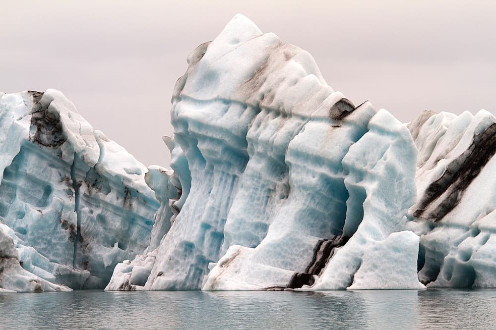
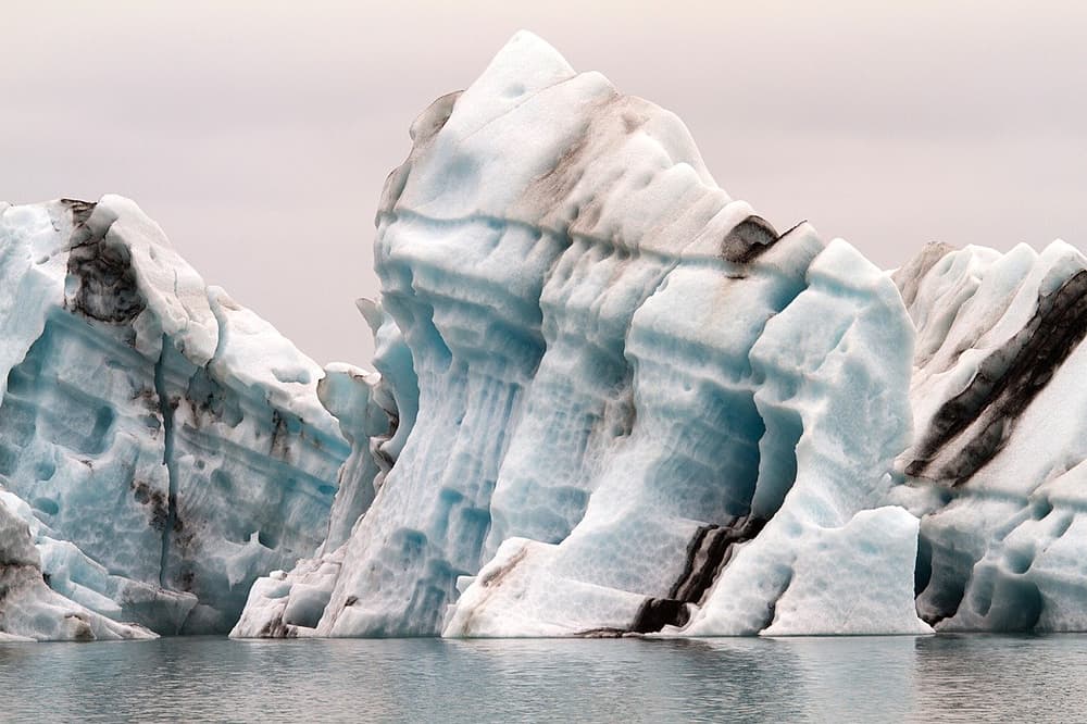
Jökulsárlón sits beside Vatnajökull, Europe's largest glacier, where icebergs calve into a lagoon before drifting out to the black sand of Diamond Beach across the road. Boat tours on the lagoon typically operate in the warmer months; check current schedules directly with the tour operator. Nearby Fjallsárlón is a quieter, smaller lagoon worth the short detour.
Dyrhólaey, a promontory near Reynisfjara black sand beach, offers a sea arch and wide coastal views, plus birdwatching. It's worth noting that Dyrhólaey is typically closed to vehicle traffic during the spring nesting season, check current status before planning around it, as dates vary by year.
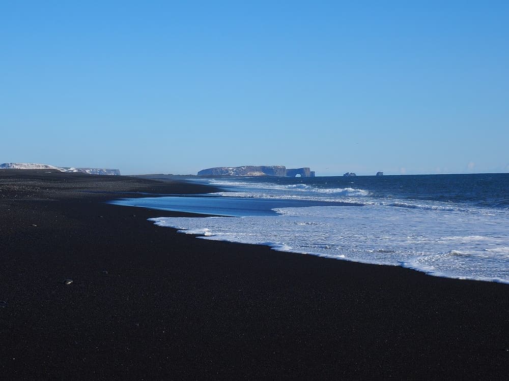
Both sit directly off Route 1, which makes this stretch one of the more forgiving parts of the Ring Road for a first Iceland road trip, even outside peak summer.
West Iceland: hot springs and lava rivers
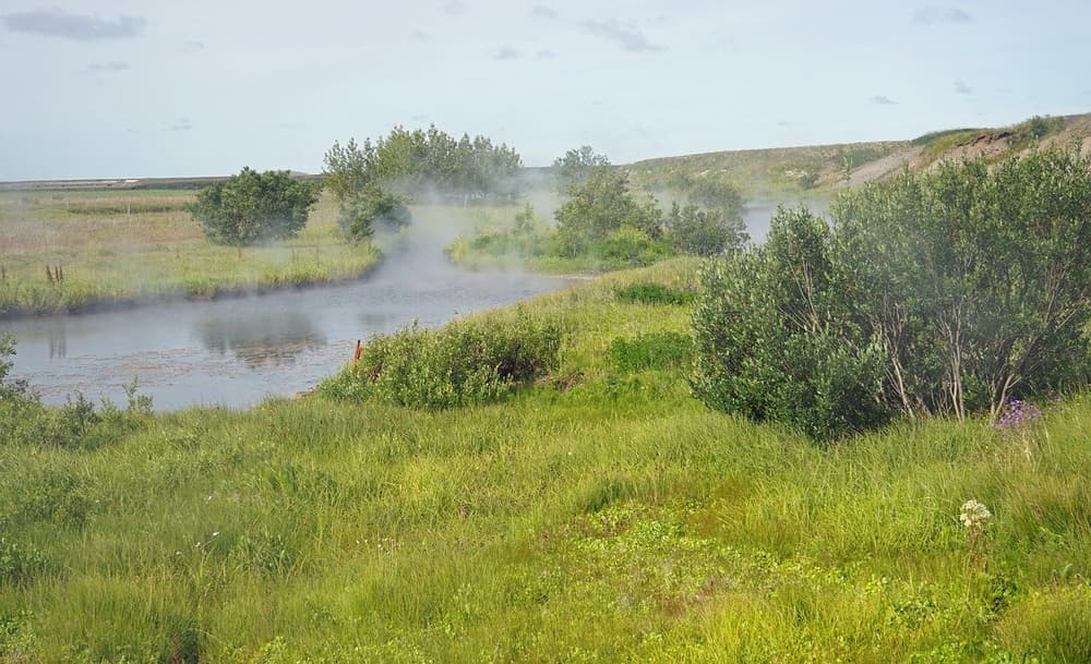
Deildartunguhver is Europe's highest-flow hot spring, and some of its water is piped to the nearby Krauma baths, where you can bathe in water drawn from the same source. The area also puts you close to Hraunfossar and Barnafoss waterfalls and within reach of Langjökull, Iceland's second-largest glacier. This region is compact and well-paved, making it a practical add-on even in winter or for travellers not planning a full ring of the island.
North and Northeast Iceland: waterfalls and volcanic ground
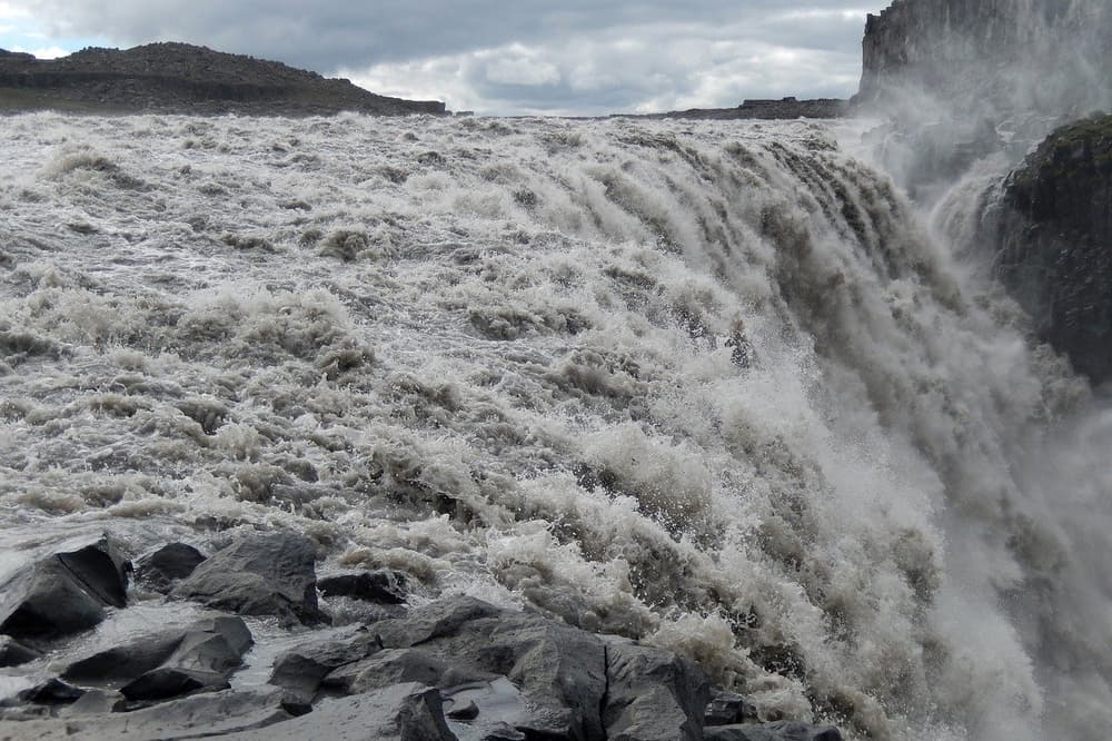
Dettifoss, often cited as Europe's most powerful waterfall by volume, sits within the Diamond Circle alongside Mývatn's geothermal areas and the horseshoe-shaped canyon at Ásbyrgi. Summer generally offers the most reliable road access to the falls; approach roads can be seasonally restricted in winter, so this is one to double-check on umferdin.is if you're travelling outside the warmer months.
East Iceland: the newer name on the list
Stuðlagil canyon, with its columnar basalt walls and a river that turned a striking turquoise after a nearby dam altered its flow, has become one of the more photographed additions to Iceland's attraction list in the past decade. It sits off the main Ring Road near Egilsstaðir, so it suits travellers doing a full loop rather than a south-only itinerary.
The Westfjords: further out, fewer crowds
Látrabjarg is one of Europe's largest bird cliffs and a reliable spot to see puffins in season. It's steep, so keep a respectful distance from the edge. Nearby Rauðisandur is one of Iceland's more distinctive beaches, with sand that shifts between gold and pink tones depending on light. The Westfjords sit further from Reykjavík and involve more gravel road driving than the south, so factor extra time and, depending on season, consider your 4x4 vs 2WD needs before committing to the detour.
Planning a route: how many attractions can you realistically see?
Trying to fit every well-known sight into a short trip is the most common mistake self-drive visitors make. Iceland's attractions are spread across the whole country, and drive times between regions add up quickly once you factor in stops for photos, fuel, and weather.
A more realistic approach is to pick one or two regions per trip, south coast plus the golden circle area, for example, or a full Ring Road loop if you have enough days, rather than trying to string together the entire list above in a single week. If you're unsure how a shorter or longer window affects what's realistic, our natural wonders overview and the canyon hiking guide both break down clusters of sights by area.
Season matters as much as distance. Summer gives you the longest daylight and the most reliable road access to gravel and highland-adjacent routes; winter narrows your options on some approach roads and changes the driving conditions on all of them. If your trip falls outside summer, read through driving in Iceland in winter before finalising your route, and check umferdin.is and vedur.is in the days leading up to departure.
Mistakes to avoid when routing between attractions
Skipping the seasonal-closure check is the one that catches out the most visitors, Dyrhólaey's spring closure, or a gravel road near Dettifoss that's fine in July and impassable in January, are the kind of details that don't show up on a map. Always verify current access on umferdin.is before driving to a remote stop.
Underestimating gravel roads is another common issue. Roads that look short on a map, particularly in the Westfjords and around some Diamond Circle sights, take longer than paved equivalents and call for a different driving approach. Our guide on choosing between a 2WD and 4x4 walks through which vehicle class suits which route.
Finally, driving off marked roads or tracks to get a better photo is illegal in Iceland and damages slow-growing vegetation and moss. Stick to marked paths and parking areas at every stop on this list.
Choosing a vehicle for this kind of route
Most of the attractions above are reachable on paved Route 1 or well-maintained gravel roads in summer, which keeps a 2WD car workable for a south-coast or west Iceland-focused trip. Adding the Westfjords, Dettifoss in winter, or any Highlands detour shifts the calculation toward a 4x4. Our full car selection covers everything from compact 2WD options to 4x4 and family-sized vehicles, and online check-in ahead of Keflavik Airport pickup means you can collect your car and start driving without extra time lost at the desk.
Whichever vehicle you choose, it's worth understanding what your insurance cover includes before you head out on gravel roads or into unpredictable weather, cover on a rental in Iceland tends to matter more here than in many other destinations, given how variable conditions can be.
 CAN YOU DRINK TAP WATER IN ICELAND?