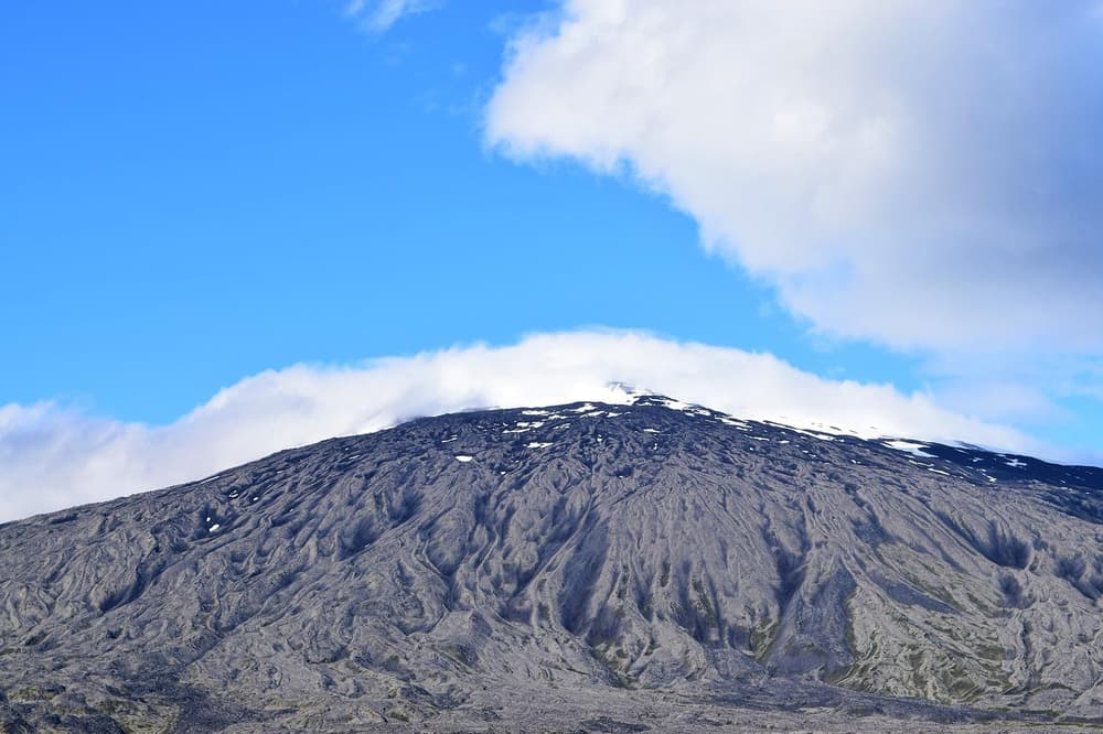

Iceland has three national parks, and each one covers a completely different part of the country: a rift valley and lake near Reykjavik, a glacier-topped peninsula in the west, and a vast glacier-and-volcano wilderness in the southeast. This guide explains what each park is known for, how they differ, and what to consider when building them into a self-drive route.
Short answer: Iceland's three national parks are Þingvellir (southwest, closest to Reykjavik), Snæfellsjökull (west, the only park touching the coast), and Vatnajökull (southeast, the largest, built around Vatnajökull, Iceland's largest glacier and one of the largest in Europe). Þingvellir is an easy half-day trip from the capital on paved roads; Snæfellsjökull and Vatnajökull both sit along or near Route 1 and are reachable in a regular car for most of the year, though winter conditions and any side roads should always be checked before you drive.
Iceland's three national parks at a glance
Each park has its own character, driving distance, and season to keep in mind. This table gives a quick comparison before the detailed sections below.
| Park | Region | Approx. size | Established | Known for | Typical access |
|---|---|---|---|---|---|
| Þingvellir | Southwest Iceland | Rift valley + Þingvallavatn lake | 1928 (UNESCO site) | Tectonic rift, Silfra fissure, Iceland's largest natural lake | Paved road, ~45 min from Reykjavik |
| Snæfellsjökull | West Iceland (Snæfellsnes peninsula) | ~170 km² | Not a UNESCO World Heritage Site (unlike Þingvellir and Vatnajökull) | Glacier-topped volcano, coastal cliffs, lava fields | Paved ring road around the peninsula, some gravel side roads |
| Vatnajökull | Southeast Iceland | ~12,000 km² | 2008 (UNESCO world heritage site) | Europe's largest glacier, Jökulsárlón, Dettifoss, Skaftafell | Route 1 for main sights; highland F-roads for the interior |
Size and access can shift slightly depending on how a given source defines park boundaries, so treat the table as a planning reference rather than a legal description, for anything route-critical, check umferdin.is before you drive.
Þingvellir National Park
Þingvellir is Iceland's oldest national park, established in 1928 and recognised as a UNESCO World Heritage Site. It sits in southwest Iceland, roughly a 45-minute drive from Reykjavik, which makes it the easiest of the three parks to fit into even a short trip.
The park's defining feature is geological: it sits directly on the boundary between the North American and Eurasian tectonic plates, which are pulling apart at a rate of about 2 cm a year. This has created a dramatic landscape of lava gorges, fissures, and cliffs, along with Þingvallavatn, Iceland's largest natural lake.
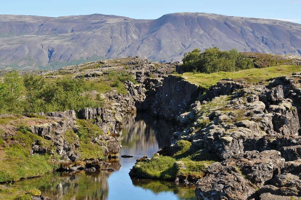
Beyond the geology, Þingvellir is also historically significant as the site of Iceland's original parliament, founded in 930 AD. Visitors can walk the rift valley, fish in the lake, ride horses, or dive and snorkel in the Silfra fissure, known for its clear glacial water. Because it's close to the capital and on sealed roads, Þingvellir is often the first stop on a Golden Circle route.
Snæfellsjökull National Park
Snæfellsjökull is named after the glacier-capped volcano at its centre, the same one that inspired the entrance to the centre of the Earth in Jules Verne's novel. It sits on the Snæfellsnes peninsula in west Iceland and is the only one of Iceland's national parks that reaches the shoreline.
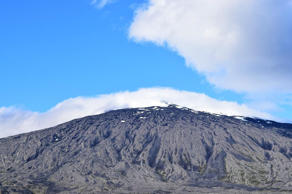
The park covers around 170 square kilometres and combines coastal cliffs, lava fields, and centuries of maritime history with the glacier itself as a backdrop. It's a good fit for travellers who want dramatic scenery without the longer drive required for Vatnajökull, and it's often paired with a stop at Kirkjufell, one of the peninsula's most recognisable mountains.
Park rangers based in the area can advise on current hiking routes and conditions, which is worth doing before setting off, since weather on the peninsula can change quickly and some trails are more exposed than others.
Vatnajökull National Park
Vatnajökull is Iceland's newest and largest national park, founded in 2008 and also recognised as a UNESCO World Heritage Site. It covers around 12,000 square kilometres in southeast Iceland, built around Vatnajökull, Europe's largest glacier, and ranks among the largest national parks in Europe by area.
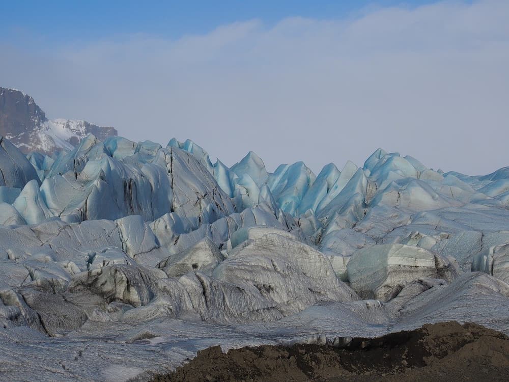
The meeting of glaciers and volcanic activity here has shaped much of what travellers come to see: black sand beaches, outlet glaciers, and glacier lagoons filled with icebergs, including Jökulsárlón. The park also contains Hvannadalshnúkur, Iceland's highest peak (enclosed by glacier ice), and Snæfell, the country's highest peak not covered by a glacier, standing over 1.8 km tall. Snæfell is the starting point for a multi-day hiking route into Lónsöræfi, past the inside of an extinct volcano.
Dettifoss, widely cited as Europe's most powerful waterfall, sits within the park's northern section, while the glacier lagoons near the south coast are easily reached from Route 1 and are among the most photographed spots in the country. Because the park spans such a wide area, most visitors see a section of it, the south coast stretch along Route 1, or the Askja/highland side via F-roads, rather than the whole thing in one visit.
Do you need a 4x4 to reach Iceland's national parks?
For the core sights in all three parks, Þingvellir's rift valley, Snæfellsjökull's ring road, and Vatnajökull's south coast section along Route 1, a standard 2WD car is generally sufficient, since these are paved or well-maintained routes. A 4x4 becomes relevant if you plan to head into the highland sections of Vatnajökull, such as routes toward Askja or other F-roads, which are legally restricted to 4x4 vehicles and typically open only for part of the summer.
F-roads are gravel, unbridged in places, and sometimes involve river crossings; conditions and opening dates vary every year and should be checked on umferdin.is and safetravel.is before you go, never assumed from a previous trip. If you're unsure whether a route requires a river crossing, the safer choice is to turn around or use an operator experienced with that specific crossing, this isn't a place to improvise. For a closer look at what these roads involve, see our guide to F-roads and the highlands and when a 2WD is enough versus when it isn't. If you're still deciding on a vehicle, these seven questions can help narrow it down.
When to visit Iceland's national parks
Summer (roughly June to August) offers the longest daylight and the widest road access, including any F-roads that open for the season. Þingvellir and Snæfellsjökull are accessible year-round by regular road, though snow and ice can affect driving conditions and visibility in winter.
Winter driving in Iceland requires more caution generally, shorter daylight, changeable weather, and icy stretches on exposed roads. If you're planning a winter visit, it's worth reading what to know before driving in Iceland in winter and the first-time visitor's winter safety guide before finalising your route. Whatever the season, check Vedur for weather and umferdin.is for real-time road conditions before each day's drive, conditions can change faster than a printed itinerary accounts for.
Getting there: driving from Reykjavik and Keflavik
Most self-drive itineraries start at Keflavik Airport, and Þingvellir, Snæfellsjökull, and the south coast section of Vatnajökull can all be reached by car from there without detours through central Reykjavik. Picking up your car efficiently matters more than it might seem, especially if you're driving straight out to Þingvellir on arrival day, online check-in and key-box pickup (for customers who add the Liability Waiver and complete online check-in) at Keflavik are designed to shorten that first step, so you're on the road sooner rather than queuing at a counter.
Choosing the right vehicle for your route also matters: a compact car suits a Golden Circle loop to Þingvellir, while a larger or 4x4 model makes more sense if Vatnajökull's highland edges are part of the plan. Our full range of cars spans 2WD, 4x4, and other categories if you want to compare before booking. It's also worth understanding what's included in your rental before you go, insurance options like gravel protection are particularly relevant on routes near Vatnajökull, where gravel roads are common even outside the highlands.
Mistakes to avoid when planning a national park route
A few recurring planning mistakes are worth flagging directly:
- Treating "visit Vatnajökull" as a single stop. The park is roughly 12,000 km², so "visiting" usually means one section, the south coast, or a highland route, not the whole area in a day.
- Assuming last year's F-road opening dates still apply. F-road access changes annually and should be checked on umferdin.is for the current season, not planned from memory or an old blog post.
- Underestimating driving distances between parks. Þingvellir is close to Reykjavik, but Snæfellsjökull and Vatnajökull are in different directions and not easily combined in one day.
- Skipping a look at parking logistics in Reykjavik if the trip starts or ends there, see our Reykjavik parking guide if you're overnighting in the city before or after the parks.
- Not budgeting time for weather delays, especially outside summer, build in a spare day if your route includes any exposed or highland sections.
 CAN YOU DRINK TAP WATER IN ICELAND?