
East Iceland is the part of the Ring Road most visitors rush through, usually squeezed between an overnight in Höfn and a long push toward Akureyri or Mývatn. That's a mistake worth avoiding. The east coast of Iceland has quieter roads, dramatic fjords, and sights like Seyðisfjörður, Hengifoss, and Vestrahorn that reward an extra day or two rather than a drive-by.
This guide covers what's actually worth stopping for between Höfn and Egilsstaðir, how to build a realistic east Iceland itinerary, and what kind of car makes sense for the region's roads.
How much time do you need to visit east Iceland?
Plan for at least two full days if you want to see the East Fjords properly rather than just pass through them. One day covers the coastal stretch from Höfn to Egilsstaðir with a few stops; a second day lets you detour into Seyðisfjörður, walk to Hengifoss, or push north toward the Langanes Peninsula. Most Ring Road itineraries allocate only a few hours here, which is enough to see Vestrahorn and Jökulsárlón but not much else.
The East Fjords section of the Ring Road (Route 1) covers roughly 120 km of coastline, but the driving is slower than the numbers suggest, the road hugs fjord after fjord, with tunnels, single-lane bridges, and sections that climb and wind. Budget more time per kilometre here than you would on the flatter south coast.
What to see between Höfn and Egilsstaðir
The route between Höfn and Egilsstaðir is the backbone of any east Iceland itinerary, and it's where most of the region's landmark sights sit. Vestrahorn, Vatnajökull National Park's eastern access points, and the fjord villages along Route 1 are all reachable without leaving the main road, though a few of the best stops require short detours.
Vestrahorn
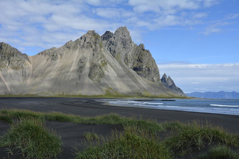
Vestrahorn is one of the few mountains in Iceland made of gabbro, formed about 6.6 million years ago, and it rises sharply above the black-sand beaches near Stokksnes, about a ten-minute drive from Höfn. It's a photography favourite year-round and especially striking on clear evenings when it's lit by the northern lights in winter. Most visitors view and photograph it from the black-sand flats below rather than hiking it, as the terrain is loose and steep.
Vatnajökull National Park
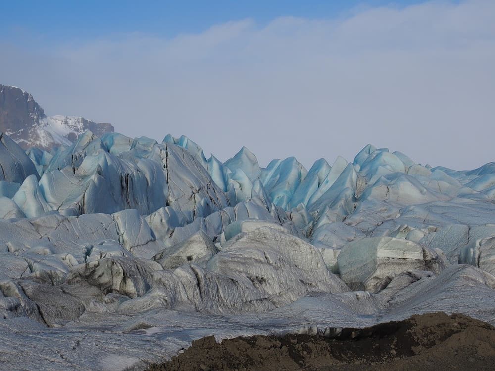
Vatnajökull National Park covers over 5,400 square miles in southeastern Iceland and includes Hvannadalshnúkur, Iceland's highest mountain, and Vatnajökull, its largest glacier. Glacier hikes and ice cave tours are typically run out of access points near the Ring Road, and most require booking with a certified guide rather than heading onto the ice independently.
Seyðisfjörður
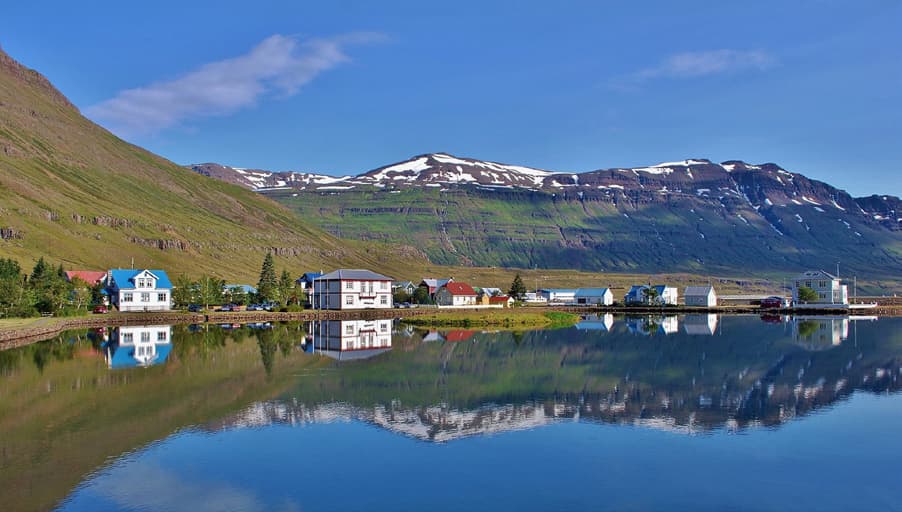
Seyðisfjörður is a small fjord town reached via a mountain pass detour off the Ring Road, known for its colourful high street, blue church, and an active arts scene, including an annual arts festival. It's one of the few east Iceland stops that feels distinctly different from the rest of the Ring Road, and it's worth the detour if your schedule allows a half-day for it. The pass into town can hold snow and ice later into spring than the coastal road, so check conditions before driving it outside summer.
Hengifoss waterfall
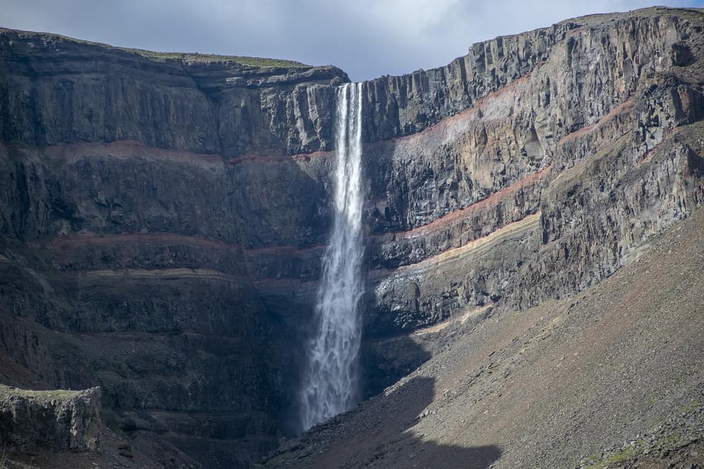
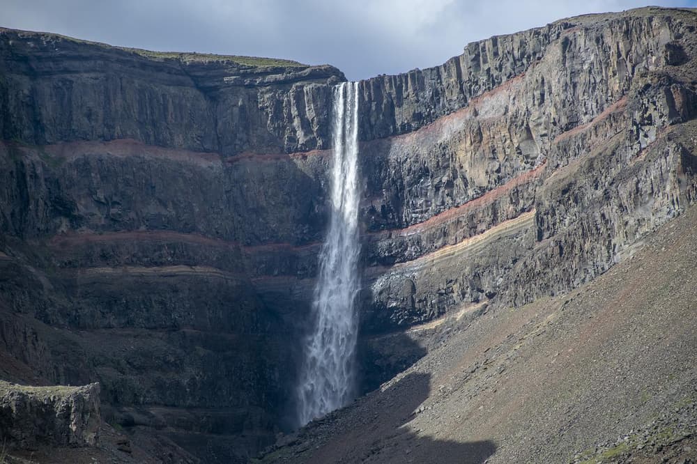
Hengifoss is Iceland's third-highest waterfall, set against a striped red-and-black basalt rock wall, and reaching it involves a hiking trail of around an hour each way. Many visitors combine it with the smaller Litlanesfoss waterfall further down the same trail along the Hengifossá river. Solid footwear is worth having, as the path is uneven in places.
Petra's Stone Collection
Petra's Stone Collection, in the village of Stöðvarfjörður, is a private garden of rocks and minerals gathered over decades by one woman, Petra Sveinsdóttir. It's a low-effort, high-charm stop for anyone driving the coastal road and takes well under an hour.
Langanes Peninsula
Langanes Peninsula, in the northeast, is a quieter detour off the main east Iceland route and one for travellers who have extra days. It's known for birdwatching, including one of Iceland's five Northern gannet colonies on the Skoruvíkurbjarg cliffs, alongside empty beaches and small fishing villages. The peninsula sits well off the Ring Road on gravel and secondary roads, so it suits a slower, less time-pressured leg of a longer trip rather than a quick Ring Road stop.
What kind of car do you need for east Iceland?
A standard 2WD car is generally sufficient for the main Ring Road route through the East Fjords in summer, since Route 1 is paved along this stretch. A 4x4 becomes more relevant if you plan to detour onto gravel roads such as those leading to Langanes, or if you're driving in winter when snow, ice, and wind are common on the fjord roads and mountain passes like the one into Seyðisfjörður.
| Route or scenario | Typical road surface | Vehicle suggestion |
|---|---|---|
| Ring Road, Höfn to Egilsstaðir (summer) | Paved | 2WD generally adequate |
| Seyðisfjörður mountain pass (winter) | Paved, but snow/ice-prone | 4x4 recommended |
| Langanes Peninsula detour | Mostly gravel | 4x4 recommended |
| Vatnajökull glacier access points | Paved to trailheads | 2WD to trailhead; guided tour for the ice itself |
| Any East Fjords driving, winter | Paved, exposed to wind and snow | 4x4 recommended |
If you're unsure which category your trip falls into, the 4x4 vs 2WD comparison and the seven questions to ask before booking a 4x4 both walk through the decision in more detail. For winter specifically, the winter driving safety guide covers what to expect on exposed roads like those around the East Fjords.
Is east Iceland good in winter?
East Iceland is drivable in winter, but conditions on the fjord roads and mountain passes change quickly and should be checked before setting out each day. Wind is a particular factor in the East Fjords, and the pass into Seyðisfjörður is one of the more exposed sections of the region's road network.
Always check current conditions with umferdin.is (Vegagerðin, the Icelandic Road Administration) and safetravel.is before driving, and check the forecast with the Icelandic Met Office. If a road is closed or a warning is in effect, the safest choice is to wait or reroute rather than push through. For a broader look at cold-season driving, see the guide to driving in Iceland in winter.
Building an east Iceland itinerary that doesn't feel rushed
Most Ring Road trips treat the east coast as a transit day, but the sights above are spread out enough that cramming them into a single afternoon means skipping most of them. A workable structure:
- Day 1: Drive from Höfn, stop at Vestrahorn and a Vatnajökull access point, continue to Djúpivogur or Stöðvarfjörður (Petra's Stone Collection), overnight near the fjords.
- Day 2: Continue north along the coast, detour to Seyðisfjörður, hike to Hengifoss, and finish in or near Egilsstaðir.
- Optional Day 3: Extend north to the Langanes Peninsula if birdwatching and remote coastline are a priority.
This pacing also fits naturally into a longer coolcation-style summer road trip that spends more time per region rather than rushing the full Ring Road in a week.
Mistakes to avoid when planning an east Iceland leg
- Underestimating driving time. The fjord roads wind considerably more than a straight-line distance suggests, budget extra time per kilometre compared to flatter regions.
- Skipping Seyðisfjörður because it's "off the main road." It's one of the most distinctive stops in the east, but it does require a deliberate detour and a bit of extra time.
- Assuming a 2WD is fine everywhere. It's generally adequate on the paved Ring Road in summer, but gravel detours and winter conditions change that calculation.
- Not checking road and weather conditions before winter departures. Conditions in the East Fjords can shift within a day; check umferdin.is and vedur.is each morning rather than relying on the previous day's forecast.
- Booking accommodation too far apart. The region is sparsely populated, and towns like Djúpivogur, Höfn, and Egilsstaðir are the practical overnight anchors, don't assume you'll find a place to stay wherever you happen to stop.
Planning the drive with a rental car
However you build your east Iceland itinerary, the car is what makes the region workable, public transport options are limited outside the main towns, and many of the best stops (Petra's Stone Collection, Hengifoss trailhead, Stokksnes for Vestrahorn) simply aren't reachable without your own vehicle.
If you're picking up at Keflavík Airport at the start of a Ring Road trip, online check-in lets you complete paperwork in advance and collect your keys from a key box (for customers who add the Liability Waiver and complete online check-in), which helps if you're arriving on an early or late flight before a long first driving day. Blue Car Rental's range of vehicles covers both 2WD options for a straightforward summer coastal drive and 4x4 models suited to winter conditions or gravel detours like Langanes. Every rental includes CDW, SCDW, Gravel Protection, Theft Protection, and Third-Party Liability as standard; note that tyre cover is not part of this base package and is only included under the optional Liability Waiver (LW), which is worth considering if you're heading onto gravel or mountain-pass routes like Langanes or the Seyðisfjörður detour. Rather than holding a deposit, Blue takes a credit-card imprint as security so no funds are blocked during your trip, details are covered in the insurance overview.
 CAN YOU DRINK TAP WATER IN ICELAND?