
There is no single "best" hike in Iceland, the right one depends on your fitness, how many days you have, and the season you're travelling in. But a handful of routes come up again and again among both visitors and locals: the multi-day Laugavegur trek, the steep climb to Glymur waterfall, the coastal paths of Snæfellsnes Peninsula, and the newer volcano trails on Reykjanes Peninsula. Below is a practical breakdown of each, plus what to check before you drive to any trailhead.
Quick answer: which hike suits you?
If you want one full day out and back, Glymur or the Hellnar–Arnarstapi coastal walk on Snæfellsnes are the easiest to plan around a self-drive itinerary. If you have three to four days and proper gear, the Laugavegur trail between Landmannalaugar and Þórsmörk is Iceland's signature trek. If you're short on time but want dramatic, recent volcanic landscape, the marked trails on Reykjanes Peninsula near the Fagradalsfjall and Sundhnúkagígar eruption sites are worth checking, subject to current access status.
Comparing Iceland's most popular hikes
| Hike | Region | Typical length | Difficulty | Best season | Access notes |
|---|---|---|---|---|---|
| Laugavegur | Landmannalaugar to Þórsmörk (South Highlands) | Multi-day (commonly 2–4 days) | Strenuous, remote | Summer only | Landmannalaugar reached via F-roads such as F208; Þórsmörk access involves river crossings |
| Glymur | Hvalfjörður, near Reykjavík | Half day | Moderate to strenuous, steep with river crossings | Late spring–autumn | Reached via a gravel road off Route 1; no F-road required |
| Hellnar–Arnarstapi | Snæfellsnes Peninsula | Half day | Easy to moderate | Spring–autumn, some winter access | Paved and gravel roads, well signed |
| Berserkjahraun & wider Snæfellsnes trails | Snæfellsnes Peninsula | Half day to full day | Easy to moderate, varies by trail | Spring–autumn | Mix of paved and gravel roads |
| Reykjanes volcano trails (Fagradalsfjall / Sundhnúkagígar area) | Reykjanes Peninsula | Half day | Varies, some paths steep or exposed to fumes | Depends on current volcanic activity | Check safetravel.is before setting out; access changes with activity |
| Svartifoss, Skaftafell | Vatnajökull National Park, South Iceland | Half day | Easy to moderate | Year-round, weather dependent | Reached via Route 1, marked park trails |
| Stuðlagil Canyon | East Iceland | Half day | Easy to moderate | Late spring–autumn | Gravel access road, check conditions in shoulder season |
Distances and trail conditions can change with weather, maintenance, and, on Reykjanes, volcanic activity, so treat this table as a starting point rather than a fixed itinerary.
Laugavegur: Iceland's classic multi-day trek
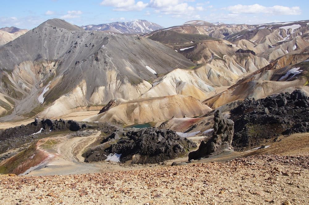
Laugavegur is the hike most people mean when they ask about "the best hiking in Iceland." It runs from the geothermal valley of Landmannalaugar south to the birch woodland of Þórsmörk, and most people cover it over several days, staying in huts or camping along the way.
The scenery changes constantly, rhyolite mountains in reds and yellows, black volcanic desert, glacier views, and green valleys near the end. It's a serious trek rather than a stroll: expect long daily distances, river crossings, and weather that can shift quickly even in summer, which is the only season it's realistically walkable.
Because both ends of the trail sit in the highlands, getting there by car usually means driving F-roads. Landmannalaugar is reached via routes including F208, and Þórsmörk's access road, F249, involves river crossings that have caught out underprepared drivers. F-roads are legally restricted to 4x4 vehicles, and conditions vary through the season, so it's worth reading our guide to F-roads and the highlands before you plan a self-drive approach, and checking umferdin.is (Vegagerðin) and safetravel.is for current status. If you're unsure about a crossing when you arrive, the right call is simply to turn around rather than attempt it, some travellers prefer to book with an experienced highland operator for the river-crossing sections instead.
Book huts well ahead if you're doing this in high summer, since capacity is limited.
Glymur: a steep half-day hike to one of Iceland's tallest waterfalls
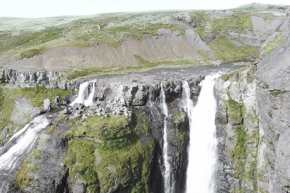
Glymur, in Hvalfjörður north of Reykjavík, is one of the country's tallest waterfalls and one of its most rewarding half-day hikes. The trail climbs steeply through a canyon, crosses a river partway up, how it's crossed varies by season and water level, so check conditions before you go, and passes through a short cave section before opening onto sweeping views over the gorge.
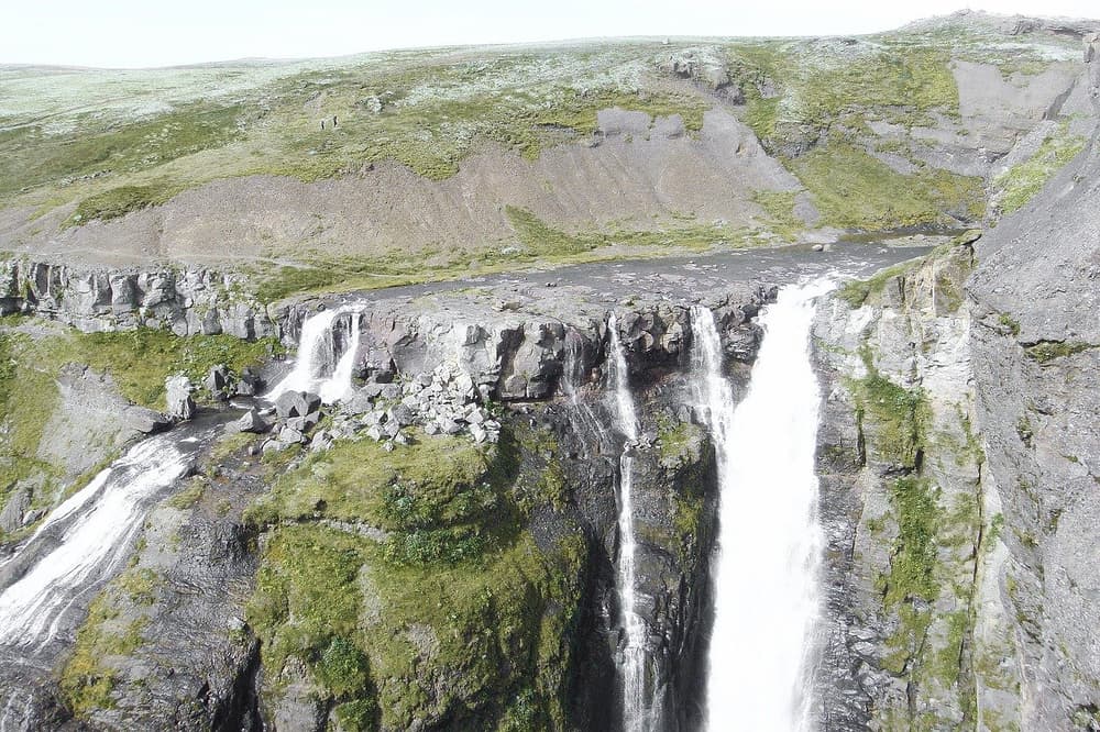
This is not a flat walk. Good boots, trekking poles, and a bit of caution on the exposed sections make a real difference. Water levels on the crossing vary by season and recent rainfall, so if the crossing looks high or fast when you arrive, it's sensible to turn back rather than push through, check safetravel.is beforehand if you're uncertain.
Glymur is easy to reach with a standard rental car: it's a short detour off Route 1 on a gravel access road, no F-road or 4x4 required, which makes it a good option even if you're travelling with a 2WD for most of your trip. If you're weighing up whether a 4x4 is worth it for the rest of your itinerary, our post on 4x4 vs 2WD in Iceland walks through when a smaller car is genuinely enough.
Snæfellsnes Peninsula: coastal and lava-field hikes in one region
Snæfellsnes, often called "Iceland in miniature," packs a wide range of hiking into a single peninsula about 2–3 hours from Reykjavík by car. The most walked route is the coastal path between the villages of Hellnar and Arnarstapi, an easy-to-moderate walk along dramatic basalt cliffs, sea arches, and birdlife-filled coastline.
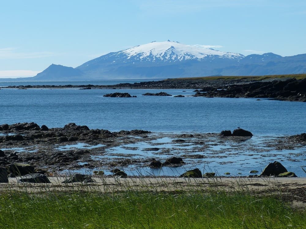
Beyond that, the peninsula offers the Berserkjahraun lava field, a stark, moss-covered field with its own quiet hiking trails, and routes closer to Snæfellsjökull glacier for those wanting higher ground. Because the terrain varies from paved paths to gravel tracks, this region works well as a single-day loop if you're touring the Ring Road or doing a Reykjavík day trip. Our overview of natural wonders around Iceland covers more of what's worth building into a Snæfellsnes stop.
Reykjanes Peninsula: hiking near recent volcanic activity
Reykjanes Peninsula, south-west of Keflavík, has seen repeated volcanic activity in recent years around areas including Fagradalsfjall and the Sundhnúkagígar area near Grindavík. Marked hiking trails exist near some of these sites, but access, closures, and safety conditions change as activity changes, sometimes with little notice.
Before heading out here, check safetravel.is and the latest updates from Icelandic authorities for the specific trail and date you're planning. Fumes, unstable ground, and active closures are real considerations in this region in a way they aren't on most other Iceland hikes, so this is one area where checking current conditions matters more than usual, rather than relying on older trip reports.
More hikes worth building into your route
A few other trails come up often enough that they're worth mentioning alongside the main four regions:
- Svartifoss, Skaftafell, a moderate half-day walk in Vatnajökull National Park to a waterfall framed by dark basalt columns, easily combined with a South Coast Ring Road day.
- Stuðlagil Canyon, East Iceland, a striking basalt canyon reached via a gravel access road, best visited late spring through autumn.
- Nauthúsagil, South Iceland, a short canyon walk near the South Coast, often paired with waterfall stops.
For a deeper look at canyon hikes specifically, see our guide to Iceland's most striking canyons.
Getting to trailheads with a rental car
Most of the hikes above, Glymur, Snæfellsnes, Skaftafell, Stuðlagil, are reachable by a standard 2WD on paved or well-maintained gravel roads. Laugavegur's highland trailheads are the exception: they typically require an F-road-capable 4x4, and river crossings on routes like F249 into Þórsmörk carry real risk if conditions are misjudged.
If you're not sure which category your planned hikes fall into, our guide on whether you need a 4x4 in Iceland is a useful place to start, and our 4x4 vs 2WD comparison breaks it down by route type. Blue Car Rental's vehicle range includes both 2WD and 4x4 options, so you can match the car to the specific trailheads on your list rather than over- or under-specifying for the whole trip.
A few practical notes that make hiking days easier logistically:
- Early starts matter for long trails like Laugavegur or Glymur in shoulder season, so online check-in and key-box pickup (for customers who add the Liability Waiver and complete online check-in) at Keflavík Airport can save time if you're heading straight to a trailhead after landing.
- Every Blue Car Rental booking includes CDW, SCDW, gravel protection, theft protection, and third-party liability as standard, which is worth knowing if your route mixes paved roads with gravel access tracks to trailheads, see the insurance overview for what's covered.
- Tyre damage, water and river crossing damage, underbody damage, wind-related door damage, and sand & ash damage are covered under the optional Liability Waiver (LW) rather than being part of the base package, worth adding if your hiking route involves river crossings or highland driving. See the insurance overview for details.
- If you're parking in Reykjavík before or after a hiking day, our Reykjavík parking guide covers the zone system.
Mistakes to avoid when planning a hike in Iceland
Underestimating weather changes. Even a "half day" hike like Glymur can turn unpleasant fast if wind or rain rolls in; check vedur.is (Icelandic Met Office) the morning of your hike, not just the week before.
Driving an F-road in a 2WD. F-roads are legally restricted to 4x4 vehicles, and this includes the roads into Landmannalaugar and Þórsmörk. Attempting them in a 2WD isn't just risky, it's outside what the vehicle and your rental terms are built for.
Treating river crossings casually. Conditions vary with rainfall, snowmelt, and time of day. If a crossing looks uncertain, turning around is the right call rather than trying to read the water yourself.
Assuming Reykjanes trails are always open. Volcanic activity has changed access on this peninsula more than once in recent years, check safetravel.is close to your hike date, not months in advance.
Skipping the gear check for multi-day treks. Laugavegur in particular demands proper boots, layered clothing, and a plan for huts or camping booked ahead in high season.
 CAN YOU DRINK TAP WATER IN ICELAND?